SearchUser loginOffice of CitizenRest in Peace,
Who's new
Subscribe |
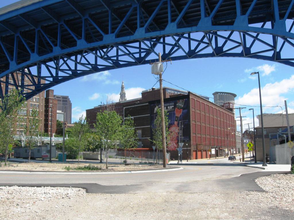
Bridge over the River CuyahogaSubmitted by lmcshane on Mon, 08/05/2013 - 03:12.
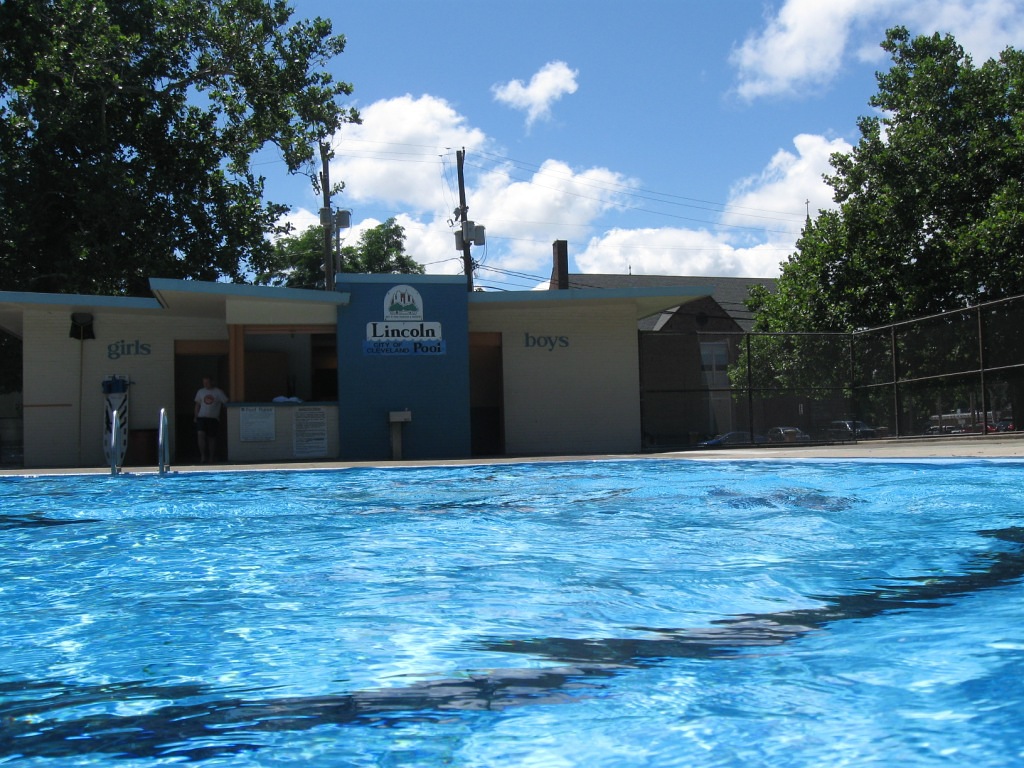
Trains share the corridor with cyclists and pedestrians on the Great Allegheny Passage. Meanwhile, in Northeast Ohio - there is one train trestle that separates the public from our lakefront. Not such an insurmountable obstacle!!! Sunday in Cleveland, Ohio - my itinerary by bike: Lincoln Park, the Flats via Scranton to photograph the trail going in (who will maintain?), via Carter to East Bank of Flats (dead and shuttered) the terminus where there used to be clubs like Fagan's lining the banks of the Cuyahoga and then Front St. to the Warehouse District - where people were out actually enjoying the perfect day.
Passed two cyclists on Scranton -
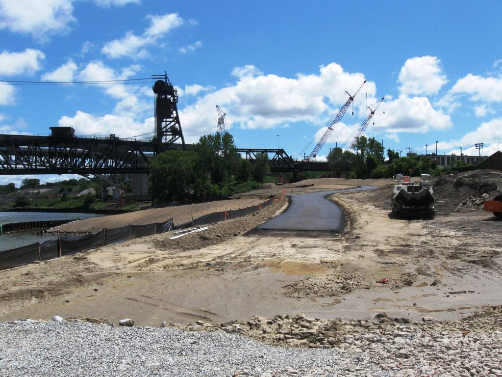
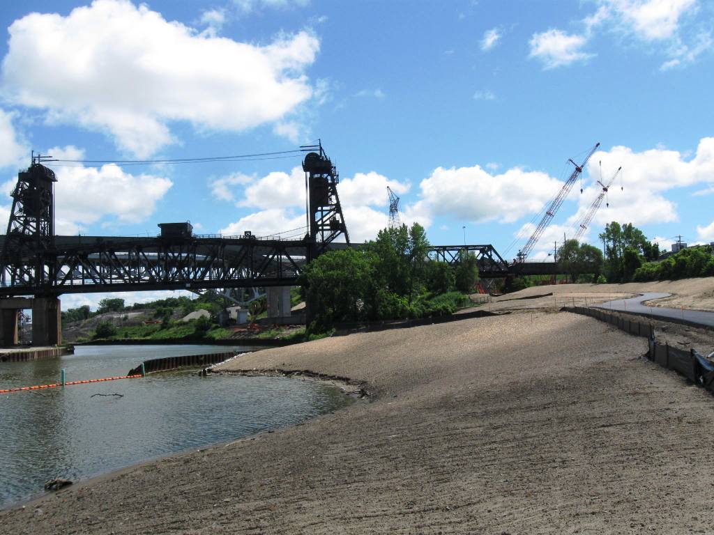
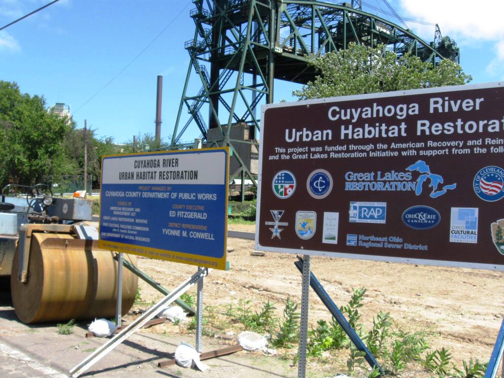
Here is the trail built with Recovery monies - it will most likely connect
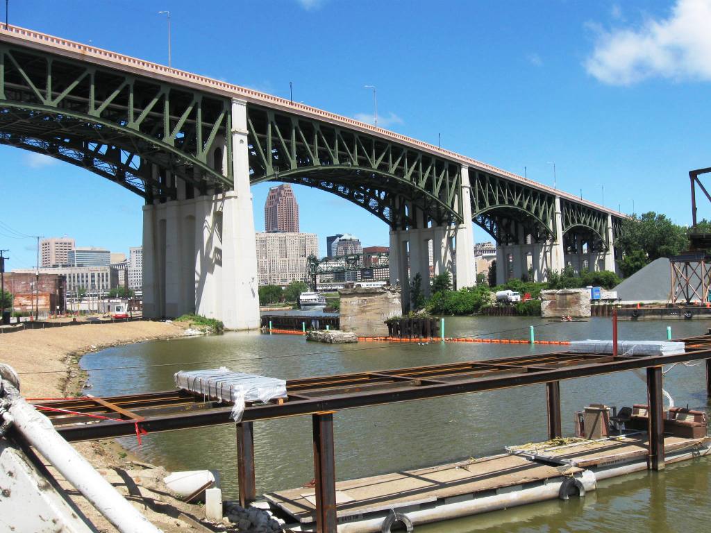
Remember Scarvelli's Marina here??
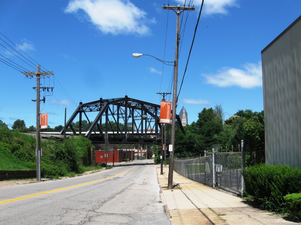
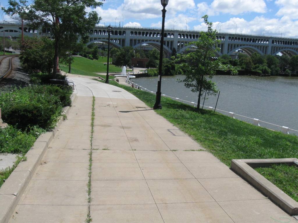
Trail looking down from University (which no longer connects to Tremont and Sokolowskis because of Inner Belt Bridge)
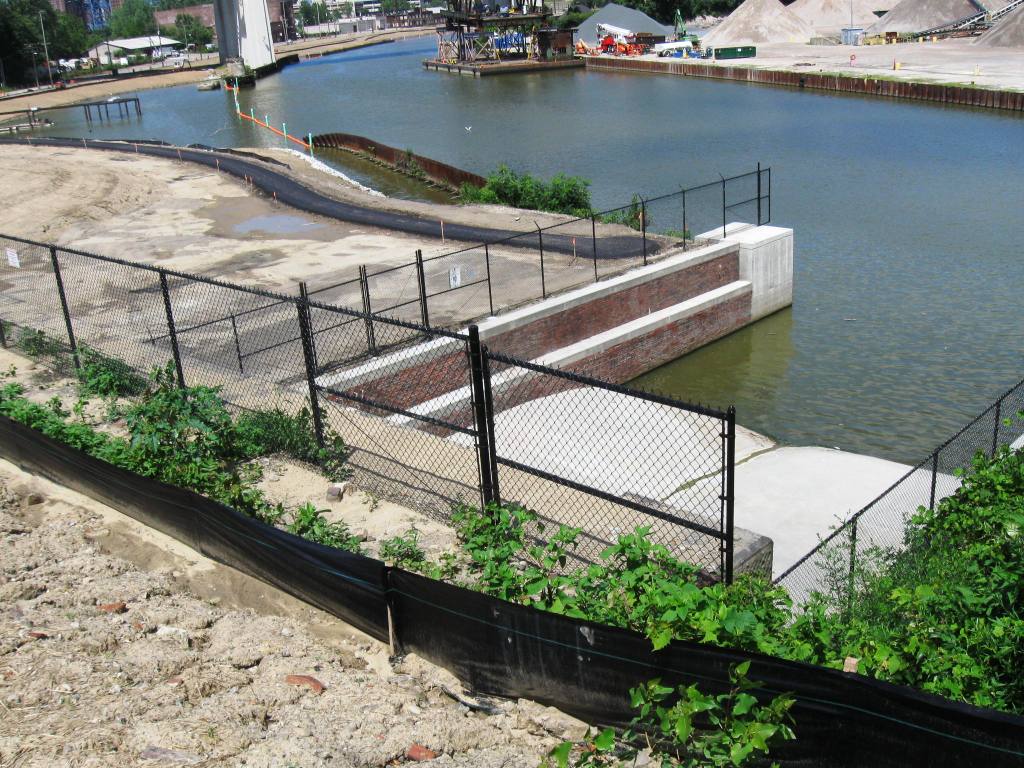
The above photo shows buried Walworth Run as it enters Cuyahoga River - just a trickle today.
http://publicworks.cuyahogacounty.us/en-US/AOC-UrbanRiparianHabitatRestoration.aspx http://www.crcpo.org/Scranton/ScrantonHabitat.html
Meanwhile -NO one at Settler's Landing Park on east bank of the Flats
NO one on the east bank - all buildings shuttered and closed!
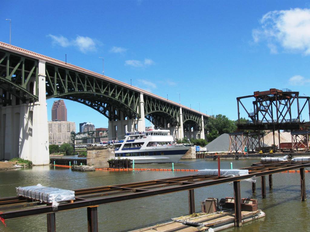
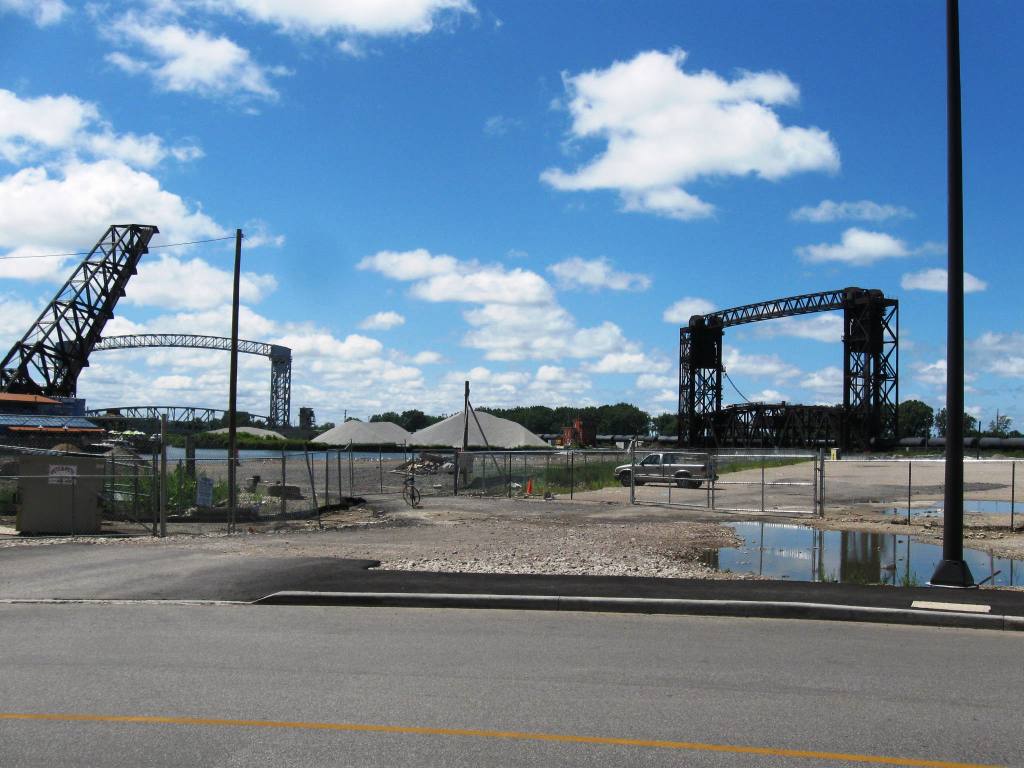
Here is terminus at Old River Rd. looking south
Here is terminus Old River Rd. looking at the trestle that connects to Whiskey Island and where Fagan's was a river front attraction. Click on the link - see how to connect East Bank with Whiskey Island - with ONE bridge cantilevered on railroad trestle that is mostly in the down position. Safety of the access can be facilitated by also cantilevering bridge on the RTA health line bridge that crosses over the existing (and busy) rail line (CSX?).
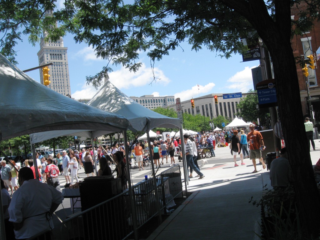
Finally! - some people - at the Warehouse District Festival.
( categories: )
|
Support Civic Journalism Recent commentsPopular contentToday's:
All time:Last viewed:
|

Redline Greenway
Kudos for Cleveland Rotary for moving mountains outside of political realm here in Northeast Ohio:
http://www.cleveland.com/architecture/index.ssf/2013/07/the_rotary_club_of_clevelands.html
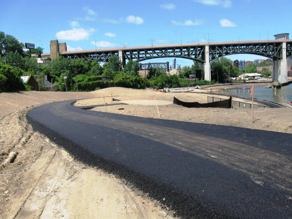
Flats Update -Towpath and Riverfront
I rode my bike to the Westside Market this past Saturday 12/28/2013 (what a madhouse)- and past the vista opened up by the construction of the Innerbelt Bridge. It is an awe-inspiring sight and it gives me hope, too - to see our waterfront, finally evolving as a place that will attract folks to appreciate our assets. See video and previous posts above.
I hope that 2014 brings some improvement to our community in NEO.
Here are some related stories:
http://www.cleveland.com/opinion/index.ssf/2013/12/proposing_a_suburban_citizen-i.html
http://www.nytimes.com/2013/12/15/travel/hotel-review-aloft-cleveland-downtown.html
BTW - the Metroparks are slated to take over the maintenance of the Scranton project.
Towpath update from my BC neighbor
I love Tim - but wish he would do more to tie in Brooklyn Centre with the Cuyahoga River and Metroparks - kudos on this work in the Flats, which apparently, will be managed by the Metroparks.
Here is the Great Allegheny Passage - completed:
PUBLIC MEETING NOTICE: Mar 6 4:30pm-DUMPING IN LAKE ERIE
WHEREAS, the Ohio Environmental Protection Agency will host a public meeting to solicit comments on this application on Thursday, March 6, 2014 at 4:30 p.m. in the Martin Luther King Jr. branch of the Cleveland Public Library, located at 1962 Stokes Blvd. on the western edge of University Circle; and
WHEREAS, this Council encourages Cleveland citizens to attend this public meeting and speak out against open-lake dumping; and
WHEREAS, this Council urges the Ohio Environmental Protection Agency to deny the Corps’ application, and force the Corps to continue the current practice of using confined disposal facilities – or work with the Cleveland-Cuyahoga County Port Authority on a workable and environmentally sound alternative to dumping; and
www.facebook.com/permalink.phpwww.facebook.com/permalink.php
https://www.facebook.com/permalink.php?story_fbid=10201851440991826&id=46672165997
Matt Zone shared on facebook.
Always Appreciative, "ANGELnWard14"
Rebrand Towpath - Canalway
Any route north of Old Harvard is not following Ohio and Erie Canal Towpath - so it is technically a separate trail. These linkages are all "Canalway" Trails - and each segment is independent but all theoretically connect the Lakefront w/the trail system that runs North and South for 110 miles with opportunities to build economic revival similar to the Trail Town program in Pennsylvania and Maryland. http://trailtowns.org/
More unnecessary engineering - Harshaw Understory
The path from existing trailhead at Old Harvard does not need to be so convoluted - it should really be called Lakefront connector as real towpath and canal ran on the east bank of the Cuyahoga River (and obviously there is not going to be a trail through Mittal-LTV-Republic Steel facility).
I am grateful that NEO has accomplished as much as it has in reinventing the Canal Corridor, but for the last stretch -off street connections can be made WITHOUT going any where near CERCLA Harshaw site. And, despite the push to connect to Tremont. More cyclists access the existing towpath via Brooklyn Centre neighborhood than through pathway behind Steelyard constructed by First Interstate.
Brooklyn Centre is also most convenient way to access lakefront when the Denison bike lanes are completed- as Denison will have dedicated lanes that connect with W. 65th and with Metroparks Lakefront Park at Edgewater. I submitted my request for a switchback that would allow families with kids to negotiate the grade change from Jennings to Denison Ave., but others also submitted request to make W. 14th the access connector.
To the credit of Stage One engineers DLZ- they are reaching out to Brooklyn Centre neighbors to address the gateway to Harvard-Denison at 1-176. This is the route most folks take to access the Cleveland Metroparks Zoo by car- along with the exit off I-71 and W. 25th- both routes take visitors through Brooklyn Centre.
http://www.nps.gov/nr/travel/ohioeriecanal/bro.htm